Up
at 04:45AM on Saturday June 9th, and out the door around 5:50AM.
Helene dropped me off. We saw
Dave Parson continuing on Barbur as we entered the freeway southbound at
Capital Hwy/Taylors Ferry Rd. I wondered
if he was going to make it to Newberg on time.
It was just about 06:00 at that time.
Dropped
my bags off at the Travelodge, the owner was up and I was able to take the bags
behind the counter. By the time we got
to the back of the hotel, Michael ?? and
Ray Ogilvie arrived before Susan France did.
I got everything set up, then Helene drove away. Finishing up registering, by needing to get
back to my bag, to retrieve the $10 registration check it left in it. I had mentioned to Susan that RidewithGPS.com
showed 11,500 ft of climbing in day 1.
She responded that a “normal” 600k brevet has about 15,000 ft. By the time I got back Michaal Wolfe had been
dropped off by his wife, and was
concerned about where he could leave his overnight bags, and I offered to have
him stow it with my things, in the office.
We went back there, an the owner had a room, and I registered and got
two keys and Michael offered to pay for ½ of the rent for the Saturday
night. Good that was settled, and off to
the start. I missed a comment that Susan
had about walking the bike, and it was the embankment along OR 18 after
crossing the South Yamhill River to get to the South River Road.
We
were off, and got split on the first light to make a left on 99W. Ray, RB, and I stayed pretty much together
the entire day. I did see Dave Parsons
coming the opposite way just at the split of the two streets in Newberg. We fully expected that he would overtake us
at some point, likely in a couple hours.
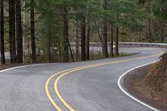
The
shoulder quality was poor through Dundee and to the turnoff for OR18, it got a
better. Then into Dayton. There’s a frontier fort replica in the
central park. The downtown is more
interesting that what we see on the Three Capes ride. Back onto 99W for a bit, then off again. The traffic is not yet
bad, even on the big roads.
Next
up is Dallas, with a Safeway. I go in,
get my breakfast sandwich that did so well on the Edens Gate, and a gallon of
water. I vowed to carry my Safeway Club Card on these rides, to save a few
pennies. Ray got some bananas and waited
in the normal checkout. RB was anxiously
waiting outside. His modus operendi is
to limit the time spent at stops by as much as possible. Ray was frustrated and vowed, yet again, to
avoid big grocery stores. RB lectured us
on how most time savings can be made at the stops, to try to do as much as
possible to be able to keep rolling. He
had me eat my sandwich rolling, as it’s better than to put a whole bolus of
food in the gut, then exercise, Its’ better for the gut and your overall time,
if the eating is metered out.
Kings
Valley was a rolling hilly countryside.
Nothing to steep, pleasant riding
country. Little traffic, too.
Blodgett
was the first Control, and is was the first wide spot in the road (US20) west
of Corvallis. Friendly proprieters. They had a small gas tank, and the pumps so
old, they had to price their pumps to the ½ gallon when the price gets too
high.
Back
on to a State Highway, and much less traffic on the way to Logsden, and
Siletz. RB’s favorite stretch of the
route. The road is so narrow that it
feels like hiking through the woods. The
a right turn on Logsden Road at Nashville, and a 16 minute stretch of picking
through smooth hard dirt road, wit h ¼ to 1/3 “ gravel strewn over the
top. No flats! Then roll into Logsden. The proprieter there offered to prepare
sandwich order, in advance, and with a weeks time, she could get avocado on
them. She wanted to let the organizers
of the rides know that, if they route through there, this resource is
available. We learned by then that
buying a gallon of water was too much for the three of us. So 1 liter bottles worked out better.
Before
Siletz, there were some serene roads, even reminding me of the alpine meadows
bordered by pine forests, in narrow valleys.
Then
on through Siletz and along the Siletz River to Siletz Bay and up the coast to
Lincoln City. It was all kinda familiar
from when we stayed at Gleneden in January 2011. It was near dinner time, and RB was more
willing to stop and eat a sandwich, which we did. I was watching the time, and appreciated RB’s
pushing, as we seemed to be ahead of my “average time” estimates from 30 to 60
minutes. The next hurdle was Neskowin by
8:00PM.
We
kept going along the E Devils Lake Rd, and then back to US101 up to OR 18 and a
wide shoulder to the Left up the Scenic US101 Route. The traffic was non-existant, and the hill
wasn’t too steep. It connected with Slab
Creek Rd, which seemed to have a steeper descent. We stopped at the Information Control, and
the question didn’t make sense, like it was coming from the opposite direction.
Rolled
into Neskowin at 19:33, a full 55 minutes earlier than my “average” brevet
speed would have put us there, that’s with all the climbing. Also found out that the store in Neskowin is
staying open until 9PM
Susan
had told us that the Little Nestucca Rd was closed for bridge work. She’d found out with TripCheck.org so we continued up US101 to Hebo. The traffic was light, and good thing as the
shoulder became narrow the closer we got to Hebo. It was dusky, but we could see the forest in
the bucolic valleys as we ascended, to meet the Little Nestucca and cross the
Coast Range again.
It
was somewhere in here, in the daylight, and being too careless, I stopped and
didn’t make sure I had control of the bike, and if fell onto its right
side. Later on, shifting into the biggest
cogs was harder to make a solid connection, the chain would skip and move to a
smaller cog. That lasted for the rest of
the day and seemed to get better, and barely noticeable on the second day. All this without doing any adjustment to the
rear derailleur cable.
The
more serious climbing was all in the dark, and I began to look forward to
seeing the Sour Grass Summit sign. It
just seemed like it took longer to arrive than I recalled. I was ahead of Ray and RB at this point, and
I kept pressing on. Made it into Grande
Ronde and stopped in front of the now closed store. With all the climbing up from Hebo, I hadn’t
kept up with nutrition, and now had a sour stomach and a headache. I just had to sit down and get more
collected. I didn’t want to get back on
that bike, feeling like I did. I must
have forced myself to eat something, but I nearly regurgitated it, at one
point. (Ala, Papa’s Branding Iron in
Albany, and about the same time of night).
I kept it down, and stayed long enough that Ray & RB passed me and I
never saw them again. I thought I might
be able to, if they ever stopped. I got
back on, and got into the Casino’s gas station, to get some Gatorade to refill
the water bottles. This last stretch
without services was long enough that the 2 liter bottle would have been a
useful thing to have.
I
was happy that I’d survived the massive climbing of day 1. And was still
rolling at a descent clip. I wasn’t too wiped out.
I
had no trouble identifying the embankment to walk the bike down to the Yamhill
River Road. And the crossing of OR18, Willamina, Sheridan, and Ballston Road
came along in due time. It was near
midnight, now, and the businesses were all closed. The coffee shop in Sheridan, seems to be
back, but probably a new owner.
Then on the same route to get back to Dayton, and
the convenience mart at 4th was closed, so continued downtown, and
back on OR18 to OR99W through Dundee and finally into Newberg. I knew I didn’t want to awaken the Motel
Owner to sign my card so I was hoping to find an ATM. Downtown Newberg delivered with a BofA on one
side and a US Bank on the other. Got my
balance inquiry at 03:04AM and looked for the motel.
Michael wasn’t there, he left a note saying he’d
continued on and was feeling good enough to keep it up. Asleep by 03:30AM, I set the alarm for
05:45AM. I took a couple minutes of head
busyness, and I let go. Next thing I
knew, I had to go to the bathroom. It
was 05:27AM, and I got to showering and then the alarm went off. Got dressed in the day two cycling gear,
nibbled at and consumed the burrito I’d carried the entire day, while drinking
one of the Diet shake cans, I was please
that my stomach felt better. It was now
a little after 06:00AM and Michael arrives, saying he made it under 24 hours
and that he’d missed the Beuna Vista Ferry Service. I told him about my stomach issues in Grande
Ronde. He said that he chugs Ensure and
Ensure + to get enough calories without upsetting his stomach. I must have
looked at the day 2 cue sheet (revised after the Little Nestucca Road was
closed) and realized I had almost an extra hour to get to the next hurdle of
Independence. I saw RB getting his stuff
prepared, and had a frozen waffle, barely thawed with syrup for a high calorie
breakfast.
Day 2:
Going across the St Paul Bridge is never fun, but
at 6:30AM on Sunday, at least the traffic is less. The shoulder is bad, bumpy and dirty. It does get better, the further away from
Newberg you get. The most improvement
was after OR219 veered off to the East while we continued straight onto St
Paul. I as alone, having seen the other
Michael with his wife in the Continental Breakfast Room of the Newberg
Travelodge. And RB getting ready. I
assumed that Ray and RB were ahead of me.
The cue sheet was dead wrong to get through Salem. Coming up from the South is easy, compared to
approaching from the North. River
through Keiser was tolerable, only because it was early enough on Sunday, but
still unpleasant. I stopped at the
Starbucks between Commercial and Liberty and consulted the GPS. And ended up
staying on Commercial through Salem. The
only difficulty is the OR22 bridge approach, but the WV bike way gets down to
Owens and then it’s rolling hills with light traffic leaving Salem. It opens up in the floodplain, and then over
the bridge and a Right into Independence.
I go to the grocery store across from the plaza, and the clerk thought
she’d already signed one of these brevet cards, that that should be
enough. I told her that each rider needs
one, so the officials know
It turns out that Ray and RB were having a
breakfast there. Like I did at the Salem
Starbucks, and had seen me on the bench swigging down my orange juice.
It was a little while, and only about a 50foot
climb to Buena Vista, giving the site it’s name by having a view over this part
of the Willamette Valley. The route
descends quickly to the ferry landing, and the ferry is on its way to the far
side. I get the camera out and take a
few pictures, the first of the ride, as casualty of RB’s efficiency. As I didn’t even know there was a third car
ferry still in operation, I took some photos, once on board, too. A older couple rolled on, too. They both had New World Tourists that were
well worn. The husband was interested in
my frame, and appreciated the fold down handlebars. They had taken may long tours, including in
Thailand. The wife made sure that I paid
attention to her odometer, as it was over 83,000 miles logged. I explained what my ride was, as they were on
a day ride from their home in Corvallis to Jefferson and back. They had previously lived in Corbett, the
wife saying that’s true Oregon. I rode
with them to the first intersection, while they turned on Talbot, to get to
Jefferson, the shorter method. I
explained to them that I was supposed to say on Buena Vista Rd S. I went about 100 yards and looked at the cue
sheet, and I, too, was supposed to make the Right at Talbot Rd. I scurried back and passed them about ½ mile
later, passing them while explaining I hadn’t paid attention to my directions.
Then a stop at a convenience mart in Jefferson,
with a dried out crispy bean and cheese burrito and a root beer. East of town got some good views of Mt
Jefferson, so I came across the idea that maybe the town was named after the
mountain. Somewhere along in here, I
came to the realization that the Mavic was no longer registering milage. Upon further investigation, nor elevation
gain, nor gradient. It continued to show
a rolling speed. On one occasion, if
blanked out and had a message that flashed by, and I thought it had to do with
having a low battery charge. Now I was
glad that I had the GPS. Heading toward the ½ way point was nice, and Tennessee
Rd was the ticket. It was a little after
1PM and I was thinking that it would do me well to stop for a bit and lay down
for a quick nap. In the country side,
everyone had a dog, and there were no public buildings. With Tennessee’s twists and turns, it finally
came to an intersection that looked like Tennesee had ended in a T with
Tennessee School Rd. I stopped and sat
on the pavement, there being next to no traffic and my orange jersey was
blatent. It was a hot sunny day, the
first I’d experienced in 2012. I had
been riding with only a jersey and shorts since before Jefferson, and that felt
good. I checked out my position on the GPS, and indeed, the intersection was
only a turn in Tennessee Rd, and coming from the other direction, there would
have been no confusion. A man and his
daughter came by and I asked them how to get to Lebanon, and he said I could
get on the highway or continue the route I was taking. After about 10 minutes, I felt better and a
few more 90 degree turns I was in Lebanon.
I knew this was an Open Control, and I saw as gas
station, but went for a bigger store more central. Then I heard my name. RB was calling me, so I got my card signed in
what was really a gas/convenience mart.
We were in a quandary for how to
get out of Lebanon and back north to the next control in Scio. The que sheet looked like it was scribble out
in highlighter, but in hindsight, that was probably the best route.
We headed out of town on Brewster and never veered
off it until making the Right on OR 233 to get into Scio. More traffic, and a mostly 11% with a section
of 12% on a ¼ mile long hill, to get us out of the valley floor. It’s probably the same hill as Richardson Gap
goes over, just on a bigger highway. RB made it up in his saddle. Ray walked, and I decided that I too, would
save my quadracepts for later in the day by not burning them up on this
hill. The hills after that were most
4-5%, much more manageable. Our route
may have been longer, too, going 13 miles.
Actually shorter, but on high trafficked raods. It wasn’t really bad, just that they were
driving fast. It was a hot day, the
first really summery day on a bike ride in 2012. We got into Scio, and finally applied some
sunscreen, and I got a Hostess Fruit Pie to take along.
In the miles before Stayton, I munched on the pie,
and when I got to the last piece, trying to push it up out of the packaging,
the whole thing slipped out of my gloved hands.
I was doing about 12mph, and I didn’t feel like stopping to pick it up
and eat it, but I felt bad about littering.
Ray did say he saw it, and almost stopped to pick it up for me.
Stayton was a few miles down the road. We turn the same way as on the Hot Springs
300km, to avoid a hill to get all the way to Shaff. I was very certain that Susan was not going
to have a secret control, reinforced by Ray’s saying that she said that we only
need worry about getting to the Controls.
A few minutes later in Aumsville, then across the freeway of OR22 to
Shaw, and then a right onto Howell Prairie Rd.
This is a long North South Route, It’s hillier on the Shaw end, and Ray
and I were amuzed by this day cyclist that was out for a spin, and we said we
were tired, he said we should be pushing bigger gears. He also had his seat too high and his hips
were rocking back and forth on the saddle.
We did stop at a crossing with a gas station, a
closed coffee cart, and a car wash.
There was a bit of shade on the east side of the coffee cart. There was a clean Subaru Forester (2004?)
with 128,000 miles for $10,400 and it looked like their bucket seats were 2-3”
higher than ours. It was getting late
enough that I set up my lights here. Not
entirely sure we’d make it back before dark.
I was beginning to really try and rest my right
shoulder, as it was “bothering” me when on the handlebars. It’s probably due to the bars being too low,
but the right triceps were bothering me more than my bottom. At least on the saddle, I can stand to pedal,
or slide back to relieve the pressure.
The shoulders are always there, and with the handlebar bag, I can’t ride
no-handed.
I also continued to notice some twinges of right
lower back pain. I could make it go away
by doing some modified cat cow yoga stretches. And it came and went, tended to
be after a big climb. It was more noticeable
on these last 30 miles on the second day of riding.
After 15.3 miles, a turn off of Howell Prairie and
getting into the northern Willamette Valley. Finally back on River Rd, RB
stopped to put leggings back on. A
couple miles later, we all stopped to put ankle reflectors on. It was now clear we wouldn’t get back into
Newberg before dark. But we did get
across the St Paul Bridge in dusk, with full rear lights ablaze. I was also figuring I had enough water to make
it to Newberg, and didn’t bother to stop in St Paul to refill. The traffic was
light, and only one truck passed us. No
serious close calls. RB knew the turns
and the distance between intersections seemed longer than in the morning of the
start of the Hot Springs 300 as we left by the same route. I had the bright idea to have the hotel clerk
sign our brevet cards, as they were there anyway, and that’s where we all
needed to go. RB and Ray drove off to
home. I showered, and searched for a
dinner, finding not much open after 10PM on Sunday other than a
Burgerville. At least it was a
Burgerville. I had a bacon burger with
fries, and felt I’d deserved it. I was
alone in the restaurant for a few minutes, when finally a young couple came in,
too.
I did it. A
600km Brevet. It also happened to occur
in the same year as completing a 200, 300, and 400, so I am a Super Randonneur!
In 2012. It’s also a check off my
“bucket” List. And I completed my 2012
New Years Resolution.
Overview. I
didn’t worry about hydration except between Hebo and Grande Ronde, and then
again from Aumsville to St. Paul, but I never felt I got too low on
fluids. I peed every 2-4hrs, and the BM
was soft. I didn’t have a scales to see
if I had water losses. I did, houwer only drink 5 of the pablum mixes,
partially offset by a couple bottle of Gatorade, or Orange Juice.
I put sunscreen on too late, at 4:00PM, or
thereabouts. Over the next days, the left cheek was red, as were above the
knees below the shorts line. No
peeling. I knew something was up, as we entered the
motel, it felt way too hot. I got to my
room and it felt like it was at least 90 degree, and looked for a way to lower
the heating. I didn’t want to counteract
it with air conditioning, so I opened the window for the night. By morning, it felt more normal.
The most soreness afterwards was my triceps and
deltoid (shoulder) on only the right side.
For four days later, I could still feel soreness in the quadrecepts when
climbing or accelerating too hard. My
bottom was not an issue, unlike the Edens Gate.
No serious mechanicals, other than the banging on
the rear derailleur. I did later examine
the tire, and the cuts and gashes on the rear weren’t any worse than
before. Maybe it will last for 2,000
miles.
In one of several bike related conversations with
Ray, I told him that I’d managed to
tighten the 13mm nut to stretch the leather saddle. He said that on all the saddles he’s ever
gotten, they come with an adjustment wrench.
I should look for my very own.
Overall, nice scenery, particularly on day 1. No flats despite the dirt road, and plenty of
crummy dirty shoulders. And the hills
did not break me down. Even the 12% on
day two, that I walked up.